Posts

With a little help from our friends

Image
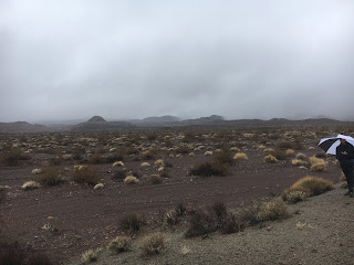
While Simone and I are out in the desert doing the grunt work of collecting data and adding protection from the teeth of desert critters, the real heroes are the folks who worked to make this possible. First, we need to thank the PIs, Whitney Behr (ETH Zurich), Thorsten Becker (UT Austin), and Vera Schulte-Pelkum (Univ. Colorado, Boulder) for conceiving of this project and putting together the proposal. Secondly, we need to thank the Southern California Earthquake Center (SCEC) for providing the funding and the National Science Foundation (NSF) for funding SCEC. Next we need to acknowledge Dan Duncan and Marcy Davis from the UT Institute for Geophysics (UTIG) for their work putting together the quick deploy boxes. Additionally, in regards to the station boxes, we need to thank RELION, a company that produces lithium-ion batteries and provided us 20 high-quality batteries at an exceptional price point.  Finally, I want to thank the Bureau of Land Management (BLM) for permitting us

Never skip leg day

Image
It's been a long while since I regularly did weight training, but a half-joking statement was to never skip leg day. I definitely paid for several skipped leg days today as we climbed up and down 145 floors worth of topography. I swear, the mantra of this deployment is, "Hey, see that mountain in the wilderness? Climb over it, then walk another kilometer and install the station." Suffice to say, my legs feel like lead weights after today. But we got to 4 stations, successfully downloaded the data, and added protection from critters who like to chew up our cables. This was our absolute hell day though. We did all 4 stations from one parking spot and they are by far the most desolate. They mostly work as a set because they are all at the north end of a big wash valley, but getting between them usually involves losing 400 feet of elevation and then gaining 800 feet of elevation. Did I mention there are no trails in the wilderness? Yeah, because there are no trails in the w

January 2019 Service Run

Image
Howdy y'all! Simone and I are back in the Mojave to fix up a few stations and collect the data since October while we're out here. So far our trip has been pretty inundated with rain. We arrived Monday mid-day and drove through the rain to a few stations. That was tough. We found 1 station had had its solar panels disconnected, so the battery was dead. Another station was having trouble connecting to the GPS and a third station had a mysteriously non-responsive sensor. After reconnecting the panels to the first station, it was up and running the next day. We also revisited the sensor with the GPS issue the next day and it was fine. The third site, with the non-responsive sensor, we couldn't catch in the field, but was a clear issue once we were analyzing the data back in the lab. It turns out, the sensor only unlocks when it is within 2.5˚ of level and this sensor was pretty far from level. We replaced it, buried it deeper, and made sure it was securely level. Once we did