Posts

Showing posts from April, 2018

19 freshly deployed stations!

Image
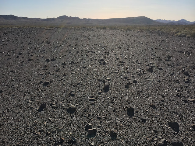
All 19 of our stations are now deployed. The UT undergrads have done amazing work. This was by far the hardest deployment I've ever done. We stressed hard rock sites in a linear array and those limitations forced our final deployment to be placed along a busy freeway (I-40) in wilderness lands. This meant that most of the stations required hiking in the ~50lbs station packs plus personal equipment and digging tools ~1-3.5km over frequently rough terrain. The stations were also constrained by permits from the Bureau of Land Management which forced us to deploy within handheld GPS accuracy (~15m) so that we would avoid desert tortoise burrows. I definitely feel like this will be one of those experiences that myself and the undergrads will look back on as a time we tested and pushed our personal limits. Now I'm excited for the data to start rolling in as these sites should be some of the quietest sites ever deployed in a passive, temporary array.  Classic desert flower.

Almost done!

Image
Today we pushed very hard, averaging 15km hiking per person, but now we're in a great condition to finish by mid-day tomorrow (Saturday). There are only 3 sites left; one is going to be a short, but painful hike as it has a lot of topography and no clear route, while the other two are further from the road but are on relatively flat hikes. In order to make the last two stations able to be finished in a single day, once the teams were done with our main goals today, we dropped the station boxes for the last two stations en route to the last two station locations. This should make deploying the last two stations significantly easier as we won't need to return to the car between sites and the total distance to be hiked carrying the ~50lbs station will be about 2km. This hiking distance is comparable to the other stations we've done and will do tomorrow. As tough as the day was, we did get some nice samples along the way. Jackie found some beautiful geodes on the trek and Da

What are we doing out here?

Image
Much of my blogging has followed the day-to-day realities of deploying seismometers and enjoying the beautiful scenery despite the difficult work, but it is also important to understand the why of what we're doing. The array is designed to help us address two very important questions: 1) What is the distribution of Eastern California Shear Zone strain below the seismogenic layer in the Mojave lithosphere? 2) How was the Mojave lithosphere modified in response to Laramide flat-slab subduction? These questions were posed by the PIs, Whitney Behr and Thorsten Becker from the University of Texas at Austin and Vera Schulte-Pelkum from the University of Colorado, Boulder, in the original SCEC proposal. As a passive source seismologist working as a postdoctoral researcher with Prof. Becker, I've been interested in these questions for a while, and am excited by how straightforward these questions should  be to address once the data is collected. Various seismological analyses will

Half-way point: the good, the bad, the exhausting

Image
We are two days in and have about half the stations in the ground. The quick-deploy boxes we developed at UT have allowed us to get the stations installed in about 1 hour, opposed to the usual 2-3 hours, but our biggest time sink is still just getting to the sites. All but one of the stations north of I-40 are wilderness lands, so no motorized equipment is allowed. That means we have some pretty serious hikes over rugged terrain with a 50lbs. pack of equipment. Today, Daniel and I hiked in a site in the Old Dad Mountains near the east end of the line. It looked fine enough; rolling hills and dry gullies, but we decided to hike up the gullies most of the way and it was tough going. We spent most of the day hoisting ourselves over river-strewn boulders in low 90's temperatures and a pretty unforgiving sun. This has definitely caused me to reconsider our daily quota of stations and I'm now quite thankful I added a contingency day to the end of the trip. The scenery, however, is

Every experiment starts with a single station.

Image
Every experiment starts with a single station, but ours started with three! We started this morning right on time, hitting the road at 8am and arriving at the hike in stop to our first site, MOJA, by about 10am. This site we did as a full team of four so I could instruct the students in station design and installation. They took to it quite well and were able to install another one as a team of two undergrads. We had some fantastic desert wildlife company today. Leopard print lizards, hares, and desert rats were scurrying all over the washes we walked down. We did have some (solvable) logistical issues with getting to the sites and, in particular, some of the hikes with a full station worth of equipment on our backs gets pretty tough, but we'll tough it out and try to find the best hiking routes in to minimize the ups and downs. Three down, 16 to go! The  UT undergrads with the UT geology truck. From left: Ashlyn Zare, Jackie Rambo, and Daniel Ortega-Arroyo. Hook 'em h

Successful first day

Our first day has been a resounding success. And by resounding success I mean there were a series of small problems, easily overcome by our team and remote help from the amazingly excellent admins at UTIG ( http://ig.utexas.edu/ ). After some early morning breakfast tacos at the AUS airport, we arrived at LAX at 9am and picked up our shiny red SUV, Elmo omlE. She's looking in great shape, so we'll be sure to fix that (although fingers crossed nothing that a good car wash won't fix!). We've also picked up a UT Gelogical Sciences truck and some tools to get the sensors in their cozy homes for the next couple years. It's always an interesting job when you split your tool store supply runs between Lowe's and Joann Fabrics, but such is the career path of a field seismologist. The sensors arrived in good shape at the Fedex Freight depot. I was very nervous as I've never shipped my equipment to a freight depot before, but after a little confusion, in which someh

Welcome to the Mojave Broadband Seismic Experiment!

Image
Howdy, ya'll! Welcome to the Mojave Broadband Seismic Experiment blog. This blog will follow the field campaign to deploy and maintain 19 broadband seismic sensors in the Mojave Desert. I, Rob Porritt, a postdoc at UT Austin will probably be doing most of the posting, but everyone in the field teams are encouraged to contribute. The experiment is designed to test the mode of deformation in the lower crust in a relatively young fault system and is funded by the Southern California Earthquake Center (SCEC). The multi-disciplinary team from UT Austin (Prof. Whitney Behr and Prof. Thorsten Becker) and the University of Colorado, Boulder (Prof. Vera Schulte-Pelkum) will use the data recorded by the experiment for fine-scale imaging of the active fault system and compare our results with information derived from mantle xenoliths.  Google Earth map of the sites. The line is situated between Needles, CA and Barstow, CA. The experiment is a linear array of sensors placed at